
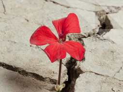
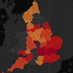
A collaboration led by Northumbria University and the Swedish University of Agricultural Sciences has for the first time mapped how land use changed across Britain throughout the last century. The new map reveals how and where some 50 per cent of semi-natural grassland was lost, including 90 per cent of the country’s lowland meadows and pasture, as the nation intensified its agriculture.
The researchers used the new map to investigate the impacts of land use change and climate change on the flora and fauna of Britain. Assembling a large citizen science dataset of some 1,192 species and over 20 million distribution records, they determined how often these factors ‘interact’ – potentially exacerbating each other to drive contractions in species’ geographic ranges.
According to the research findings, interactions between these factors were relatively rare, affecting less than one in five species. Where they did occur, their combined effect on extinction risk was often weak. Overall, the researchers found that 16 per cent of species were negatively affected by climate warming, land conversion or both, being more likely to disappear from areas where such changes have taken place.
Finding that species’ responses to environmental change were highly individual, or ‘idiosyncratic’, the researchers concluded that it was difficult to generalise across the taxonomic groups they studied (plants, birds, butterflies, and moths). They highlight a need to include species-specific information in efforts to mitigate climate change impacts or the extinction crisis.
.png?h=350&w=350&modified=20231027110616&hash=3C8A6E333F96C5E1337587CB483C7EB0) Dr Andrew Suggitt, an ecologist from the Department of Geography and Environmental Sciences at Northumbria University who
co-led the research, said: “We’ve known for a while that the two most prominent
drivers of biodiversity loss – land use change and climate change – can interact
to worsen each other’s effect on species. But until now we have lacked digital maps
of land use that go back far enough to cover the substantial changes associated
with the intensification of agriculture that peaked in the mid-20th century, when semi-natural grasslands were converted, hedgerows were removed,
and more land was brought into production.
Dr Andrew Suggitt, an ecologist from the Department of Geography and Environmental Sciences at Northumbria University who
co-led the research, said: “We’ve known for a while that the two most prominent
drivers of biodiversity loss – land use change and climate change – can interact
to worsen each other’s effect on species. But until now we have lacked digital maps
of land use that go back far enough to cover the substantial changes associated
with the intensification of agriculture that peaked in the mid-20th century, when semi-natural grasslands were converted, hedgerows were removed,
and more land was brought into production.
“Our map allowed us to test for interactions between climate change and land use change during this important episode of upheaval in the mid-to-late 20th century. We found that these factors don’t often interact to drive range retractions, which is good news, but the highly individual character of the responses will mean that we need to include species-level information in policies aimed at climate change adaptation or biodiversity goals.”
 Dr Alistair Auffret, an ecologist at the Swedish University of Agricultural Sciences who also co-led the research, said:
“Semi-natural pastures and meadows are hotspots of biodiversity across Europe,
and we were sadly not surprised by the extent of their loss in Britain during
the 20th century. Our results showed that retaining these habitats
was important for reducing local losses in specialist species, but it remains the
case that many such species are under threat. Conserving and restoring natural
and semi-natural habitat in line with international agreements and targets
should be a priority going forward.”
Dr Alistair Auffret, an ecologist at the Swedish University of Agricultural Sciences who also co-led the research, said:
“Semi-natural pastures and meadows are hotspots of biodiversity across Europe,
and we were sadly not surprised by the extent of their loss in Britain during
the 20th century. Our results showed that retaining these habitats
was important for reducing local losses in specialist species, but it remains the
case that many such species are under threat. Conserving and restoring natural
and semi-natural habitat in line with international agreements and targets
should be a priority going forward.”
The study, Linking climate warming and land conversion to species’ range changes across Great Britain, is published in Nature Communications, and is available to read here: https://doi.org/10.1038/s41467-023-42475-0
The land use change maps for Britain are freely available for download at: https://doi.org/10.5878/9wks-qg91
Banner Image*: The land use of Newcastle-upon-Tyne as surveyed by the Land Use Survey of Britain between 1931 and 1935 (Copyright: Giles Clark, CC-BY-NC-SA).
Geography At Northumbria University Encompasses All Of Our Work In Physical And Human Geography, Environmental Science And Management, Health & Safety, And Disaster Management.
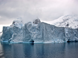
The guiding vision of Extreme Environments is to understand and harness the physical and biological environments that operate under extreme conditions and stresses, and to develop research that will have tangible impacts on an environmental, technological, economic and societal basis at regional, national and global levels.
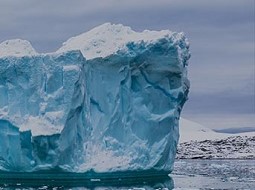
Northumbria's academics are studying the future of ice sheets and glaciers worldwide in a warming world. This involves understanding the causes of ongoing changes in Antarctica, Greenland and alpine areas, as well as assessing future changes and resulting impacts on human environments globally.
Latest News and Features
Northumbria University named among 35 founding members of Defence Universities Alliance
Northumbria has been selected as a founding member of the Defence Universities Alliance (DUA),…
Researchers exploring hidden reasons women with MS struggle each month
Northumbria University researchers are calling on women to support a new study, which could…
North East stars among leaders honoured by Northumbria University
Northumbria University is awarding honorary degrees to 14 distinguished individuals at its…

Creative talent shines as Northumbria celebrates 70 years of Fashion at Graduate Fashion Week
The creative skills of final year Fashion students from Northumbria University have once again…
From Columbia Records to Creative Writing: Northumbria student Victoria Flemming wins Northern Writers’ Award
A Northumbria University Creative Writing student who built a career at Columbia Records and…
Northumbria named in UK's top 50 employers of veterans
Northumbria University has been named one of the 50 GREAT British Employers of Veterans 2026…
AI in policing: safeguards can't keep up, new research warns
Artificial intelligence is being adopted across policing and the wider criminal justice system…
Northumbria in top 35 universities worldwide for sustainability
Northumbria University is officially one of the best universities in the world for sustainability,…
More events
Upcoming events

Next Stop Northumbria
The Queens Hotel, Leeds
-
Restorative Just Culture Research Dissemination Event
Northumbria University
-

NU-NHSA Launch Event
Northumbria University
-
The Past We Inherit. The Future We Build: Better Decisions Happen Together
The Great Hall, Sutherland Building
-
